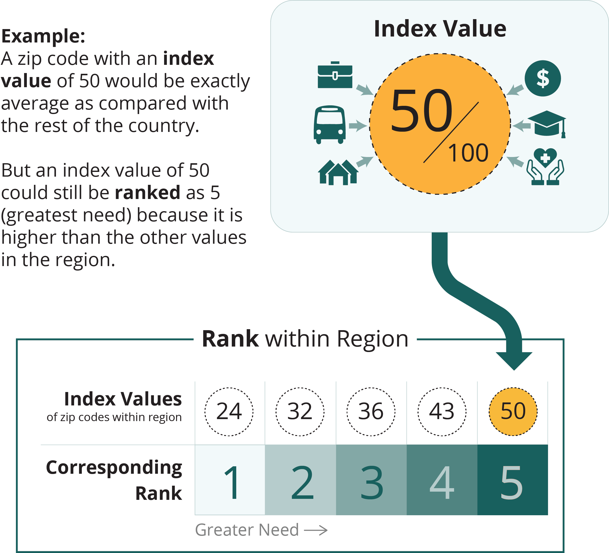
The 2024 Food Insecurity Index, created by Conduent Healthy Communities Institute, is a measure of socioeconomic and household hardship correlated with poor food access. The index is part of Conduent's SocioNeeds Index® Suite, which provides analytics around social determinants of health to advance equitable outcomes for a range of topics.
All zip codes, counties, and county equivalents in the United States are given an index value from 0 (low need) to 100 (high need). To help you find the areas of highest need in your community, the selected locations are ranked from 1 (low need) to 5 (high need) based on their index value relative to similar locations within the region.

map legend
greater need


| Zip Codesort column | Indexsort column | Ranksort column | Countysort column |
|---|---|---|---|
| 62518 | 94.2 | 5 | Logan |
| 62703 | 93.2 | 5 | Sangamon |
| 62701 | 92.0 | 5 | Sangamon |
| 62522 | 88.6 | 5 | Macon |
| 62702 | 87.6 | 5 | Sangamon |
| 62526 | 84.3 | 5 | Macon |
| 62510 | 77.0 | 5 | Christian |
| 62635 | 73.9 | 4 | Logan |
| 62521 | 72.8 | 4 | Macon |
| 62661 | 68.5 | 4 | Sangamon |
| 62650 | 65.7 | 4 | Morgan |
| 62704 | 65.2 | 4 | Sangamon |
| 62530 | 64.6 | 4 | Sangamon |
| 62568 | 64.0 | 4 | Christian |
| 61723 | 62.9 | 4 | Logan |
| 62665 | 58.8 | 4 | Morgan |
| 62548 | 58.6 | 4 | Logan |
| 62558 | 53.6 | 4 | Sangamon |
| 62656 | 52.4 | 4 | Logan |
| 62515 | 51.3 | 4 | Sangamon |
| 62567 | 50.2 | 4 | Christian |
| 62557 | 45.4 | 3 | Christian |
| 62573 | 44.3 | 3 | Macon |
| 62501 | 41.4 | 3 | Macon |
| 61756 | 39.1 | 3 | Macon |
| 62520 | 38.7 | 3 | Sangamon |
| 62513 | 38.4 | 3 | Macon |
| 62551 | 37.9 | 3 | Macon |
| 62692 | 37.6 | 3 | Morgan |
| 62512 | 37.0 | 3 | Logan |
| 62670 | 36.2 | 3 | Sangamon |
| 62561 | 36.0 | 3 | Sangamon |
| 62544 | 35.2 | 3 | Macon |
| 62693 | 34.7 | 3 | Sangamon |
| 62668 | 34.4 | 3 | Morgan |
| 62543 | 33.9 | 3 | Logan |
| 62628 | 32.3 | 3 | Morgan |
| 62535 | 31.2 | 3 | Macon |
| 62540 | 30.1 | 3 | Christian |
| 62539 | 25.4 | 2 | Sangamon |
| 62556 | 23.7 | 2 | Christian |
| 62643 | 23.6 | 2 | Logan |
| 62638 | 23.5 | 2 | Morgan |
| 62546 | 23.2 | 2 | Christian |
| 62601 | 23.2 | 2 | Morgan |
| 62545 | 18.8 | 2 | Sangamon |
| 62615 | 18.7 | 2 | Sangamon |
| 62629 | 17.5 | 2 | Sangamon |
| 62549 | 16.3 | 2 | Macon |
| 62555 | 16.1 | 2 | Christian |
| 62531 | 15.8 | 2 | Christian |
| 62707 | 14.8 | 2 | Sangamon |
| 62712 | 13.0 | 1 | Sangamon |
| 62547 | 12.8 | 1 | Christian |
| 62554 | 12.7 | 1 | Macon |
| 62677 | 11.2 | 1 | Sangamon |
| 62570 | 9.1 | 1 | Christian |
| 62634 | 7.3 | 1 | Logan |
| 62666 | 7.0 | 1 | Logan |
| 62563 | 6.8 | 1 | Sangamon |
| 62711 | 6.8 | 1 | Sangamon |
| 62671 | 3.7 | 1 | Logan |
| 62684 | 0.8 | 1 | Sangamon |
| 62625 | 0.4 | 1 | Sangamon |
Data Source
The Food Insecurity Index is calculated by Conduent Healthy Communities Institute using data from Claritas Pop-Facts®, 2024; Claritas Consumer Spending Dynamix, 2024; and American Community Survey 2018-2022.
Technical Note
Index values are not comparable across measurement periods. Index values and rankings are specific to a measurement period, showing the relative ranking of a location in comparison to other similar locations at that time.
